GEOGRAPHY AND HISTORY
1ESO SOCIAL STUDIES
  • HOME
  • IES ÁNGEL CORELLA
  • DOCUMENTS AND MATERIALS
  • CV HOMEWORK
  • NEWS
    • Supporting materials
    • Handouts
    • NEWS PRESENTATIONS >
      • 2016-17
      • 2018-2019
  • MAPS
  • Developing skills in History
    • TIMELINES
    • CLIMOGRAPHS
    • Mind Maps
    • Presentations
  • GEOGRAPHY
    • UNIT 1: PLANET EARTH >
      • Power point revision
      • Homework
      • Mind map unit 1
    • UNIT 2: THE EARTH´S PHYSICAL CHARACTERISTICS >
      • Power point revision
      • Mind map Relief and Hydrosphere
      • I.D.A.C and some homework
      • Projects and presentations >
        • 2013-14
    • UNIT 3: THE CONTINENTS
    • UNIT 4: THE CLIMATE AND BIOCLIMATIC ZONES >
      • Power point revision
      • Homework
      • Projects and presentations >
        • 2012- 2013
    • UNIT 5: THE EARHT´S MAJOR BIOCLIMATIC ZONES >
      • Project
      • Homework
    • UNIT 6: EUROPE/SPAIN
    • UNIT 7: LANDSCAPES >
      • Homework
      • Projects and presentations >
        • 2013- 2014
  • HISTORY
    • UNIT 8: PREHISTORY >
      • Power point revision
      • Homework >
        • Prehistory timeline
        • Human Evolution chart
        • Paleolithic and Neolithic
        • Art and tools foldable
      • Projects and presentations >
        • 2013-14
        • 2016-17
    • UNIT 9: MESOPOTAMIA >
      • POWER POINT REVISION
      • Homework
      • Projects and presentations >
        • 2012-13
        • 2013-14
    • UNIT 10: EGYPT >
      • POWER POINT REVISION
      • Homework
    • UNIT 11: ANCIENT GREECE >
      • Power point review 2017
      • Homework >
        • Homework 2013-14
      • Projects and presentations >
        • 2012-13
        • 2013-14
    • UNIT 12: ANCIENT ROME >
      • Power point revision 2017
      • Homework
      • Projects and presentations >
        • 2012-13
        • 2013-14
    • UNIT 13: ANCIENT IBERIAN PEN. >
      • HOMEWORK
      • Homework
      • Projects and presentations
  • SUPPLEMENTAL MATERIALS
  • TRIP TO DUBLIN
    • General information
    • Blog 2013
    • BLOG 2014
    • Blog 2015
  • ANNOUNCEMENTS
    • Upcoming exams
    • General information
  • Mannequin Challenge
  • Blog
  • EVENTS AND OTHERS...
    • Carranque excursión 2019
    • CARRANQUE´S EXCURSION 2018
    • CARNAVAL 2017
  • Coronatareas
  • Link Page

MAPS

Here you have our beloved corner of maps. I´ll try to upload some samples and also some  interesting links to pages in which you can find help to  learn (remember, by heart...) the physical features you have to study. I know it is not easy for everyone but it is very practical and useful and if you find the way... even entertaining...

LET´S TRY

First of all, and also for students of other years... the physical features of the continents:

PHYSICAL EUROPE

This is the power point I have prepared for you to check your knowledge about Europe. I hope it is useful for you and you can study easly. It is showed as a file and as a document because I don´t know what type is easier for you to use.
physical_europe.pptx
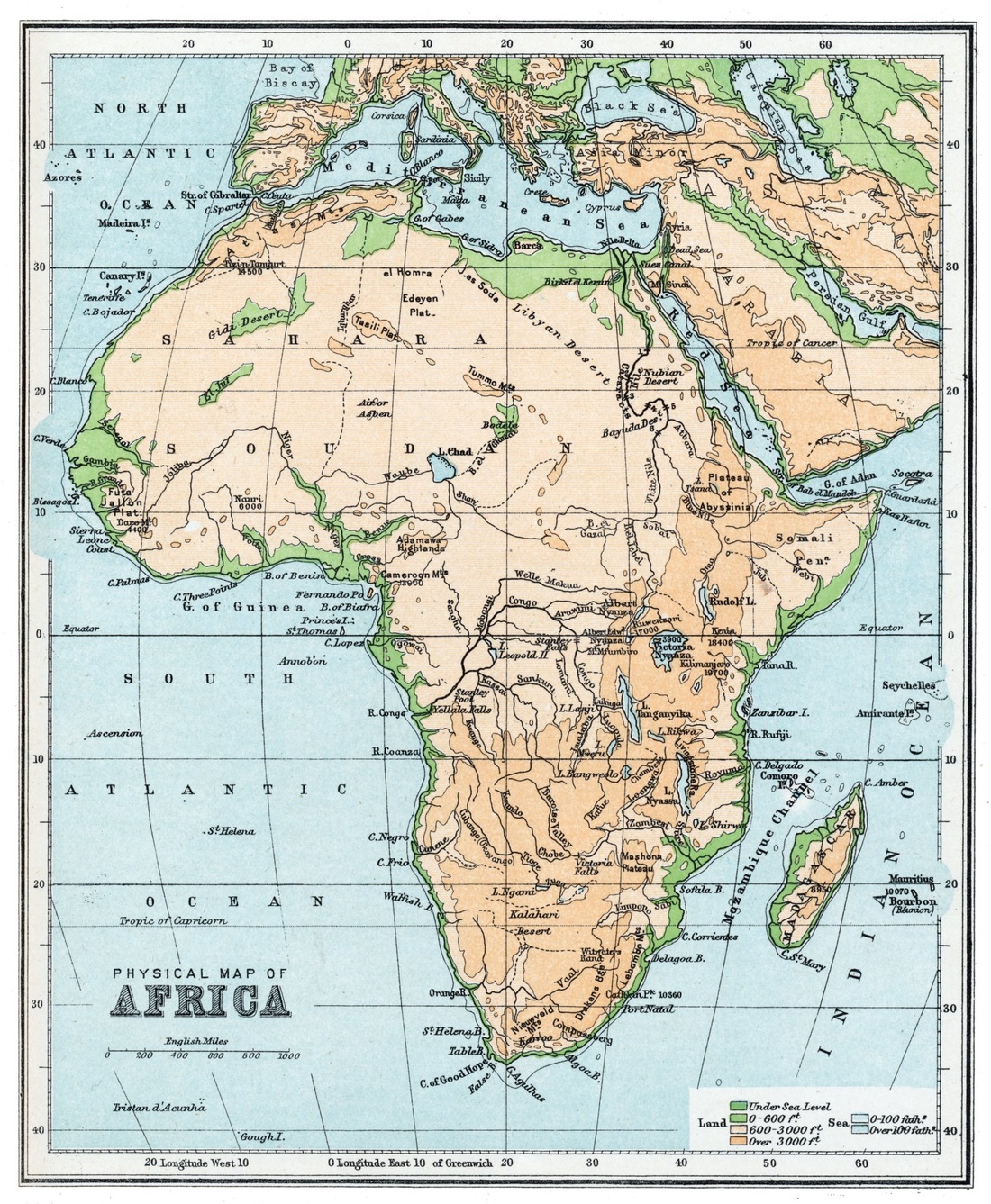
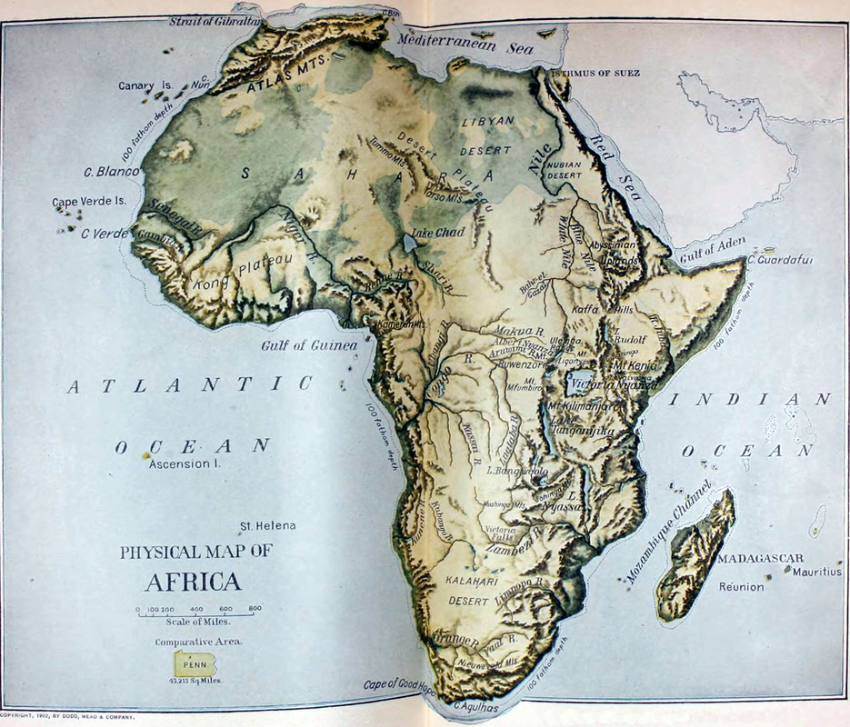
File Size: 1811 kb
File Type: pptx
Download File

PHYSICAL AFRICA

This is the power point  corresponding to the physical map of Africa. I hope you learn a lot with it. Again you can use both documents to your convenencie
africa__2_.pptx
File Size: 1194 kb
File Type: pptx
Download File

This is a very useful video to know more about the physical characteristics of Africa. Please, have a look at it because by doing it  you will be revising climates, landscapes and other contents.

This is a link to a web in which you can find the Africa phyiscal map to print and to practice with it

http://www.colegiorosales.es/webalumnos/sociales/mapas/m09.jpg


This is the map of Africa with the main physical features located. I hope it helps you to study
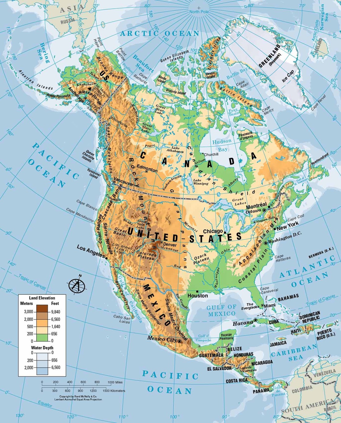
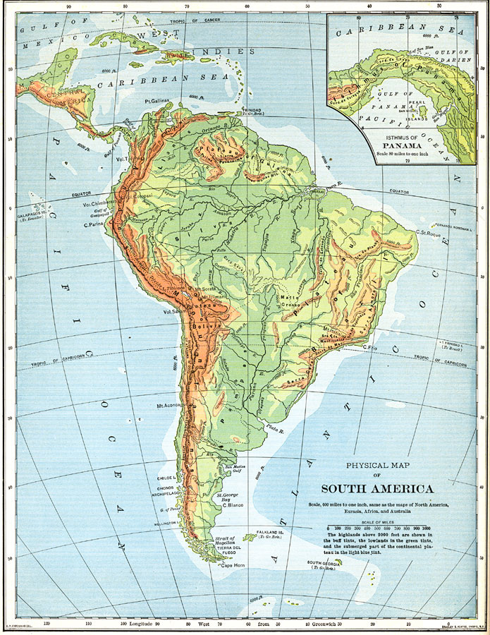
Imagen
Imagen

PHYSICAL AMERICA

This is the power point  corresponding to the physical map of America. I hope you learn a lot with it. Again you can use both documents to your convenencie
physical_america_2.pptx
File Size: 3408 kb
File Type: pptx
Download File

These videos explain the physical features of North and South America. Have a look at them to fix some of those physical features that you have already studied  and to learn more about their geography
Here you have some maps of America in which you can locate the physical features of the list
Imagen
Imagen

PHYSICAL ASIA

Here you have the power point of the physical features of Asia, one as a document , the other as a file four you to use it to study...
physical_asia.pptx
File Size: 2021 kb
File Type: pptx
Download File

Imagen

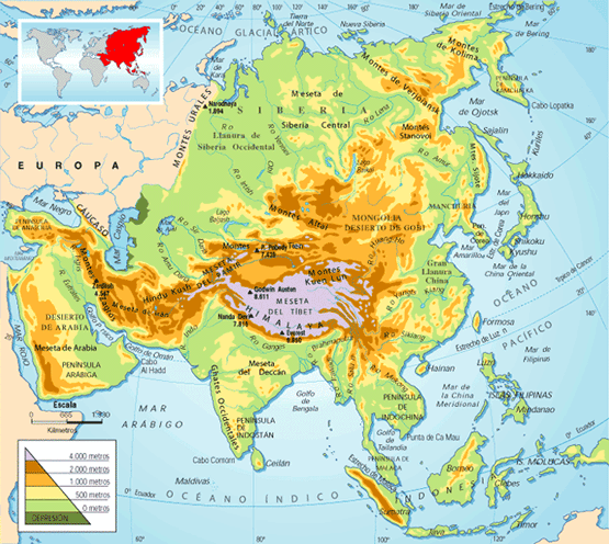
This is an interesting video that shows some of the most important physical features of Asia related to its people. You will learn lots of interesting facts....

SPAIN: POLITICAL AND PHYSICAL

Here you have the physical features of Spain and also the maps corresponding to the physical features and the political.
phisical_spanish_map.pdf
File Size: 1648 kb
File Type: pdf
Download File

spanish_political_map.pdf
File Size: 438 kb
File Type: pdf
Download File

Here you have some videos about Spain and its Geographyy, the second one is quite innteresting but it must be seen only from minute 43:50, before than that it is a general presentation of the geographical series

Powered by Create your own unique website with customizable templates.